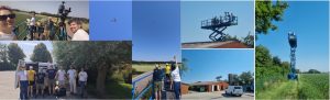
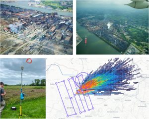
The MAGIC-AVALON campaign
In the summer of 2025, three major European satellites have been launched: MTG-S on July 1st, MicroCarb on July 25th and Metop-SG-A1 on August 12th. Several instruments aiming at the observation of atmospheric composition and related surface emissions can be found of these platforms, such as IASI-NG and IRS infrared sounders, Sentinel-4 and 5 or 3MI. The calibration/validation phases of all these missions are planned to last until the end of June/July 2026.
An ambitious field campaign has been planned by a European consortium (France, Belgium, Germany and United Kingdom) to participate to the validation exercises of these missions, prepare the next generation of atmospheric space missions and address key scientific questions on anthropogenic greenhouse gases: the MAGIC-AVALON (Aircraft VALidation Of New-generation satellites) campaign.
Over the full month of June 2026, an international consortium of about 90 scientists will operate a battery of instruments deployed on the ground, onboard hundreds of weather balloons, as well as onboard three research aircrafts. Measurements will take place over France and Belgium.
The campaign is led by CNRS-LMD and supported by three European Space agencies: CNES (Centre National d’Etudes Spatiales), ESA (European Space Agency) and EUMETSAT (European Organisation for the Exploitation of Meteorological Satellites).
Scientific objectives
The MAGIC-AVALON campaign aims at providing an extensive knowledge of the state of the atmosphere and the surface at the overpassing time of the satellites in order to address three scientific objectives:
- SO1: To validate newly launched European satellites: Metop-SG-A1, MTG-S and Microcarb.
- SO2: To provide urgently needed data on anthropogenic greenhouse gases and related gases (CO2, CH4, N2O, CO, HN3) for quantifying anthropogenic emissions with a focus on agriculture and farming.
- SO3: To prepare future European space missions, such as ESA Earth Explorer missions.
To reach these objectives, main targets are the measurements of: temperature, H2O, O3, CO2, CH4, CO, N2O, NO2, NH3 and aerosols.
Campaign characteristics
The campaign is expected to take place between 1-28 June 2026. This time period corresponds to the end of the validation phase of most instruments onboard Metop-SG-A1 and MTG-S and provides good measurement conditions in Western Europe. Moreover, a specific flight condition implemented by EUMETSAT will cover the two first weeks of the campaign: the Metop-C/Metop-SG-A1 tandem flight, during which these two satellites will closely follow each other on the same orbit in order to cross-validate both of them.
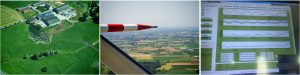
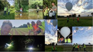
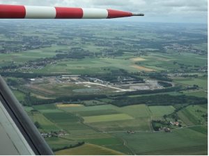
Measurements will take place over most of France and North-West Belgium. The campaign will build on several French instrumented sites: two stations part of the AirCore-France network (Aire-sur-l’Adour CNES site and MDH-Reims site), Lannion CMS site of Météo-France and SIRTA at Ecole polytechnique. All of these stations will be used to daily launch weather ballons in order to measure atmospheric profiles of temperature, humidity, atmospheric gases and aerosols. They will also host several ground-based instruments that will continuously measure various atmospheric and surface variables. Research aircrafts will be deployed to fly over satellite tracks, linking all sites together.
In addition, two specific regions will be extensively monitored: Flanders (Belgium) and Brittany (France). These two regions are strong emitters of methane and amonia, as well as carbon dioxide. They will be used to evaluate the capability of current and future space missions to capture these anthropogenic emissions.
The instruments
About 40 instruments will be deployed during MAGIC-AVALON:
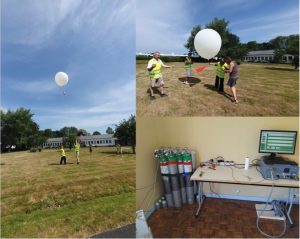
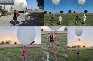
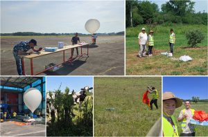
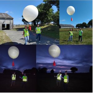
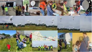
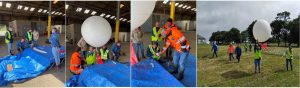
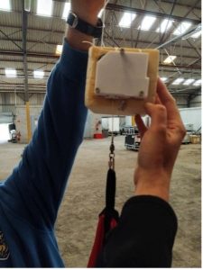
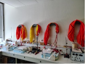
- 120 weather balloons should be launched from the 4 identified stations described above. They will carry: AirCore-light atmospheric samplers, meteo sondes, ozone sondes and particule counters.
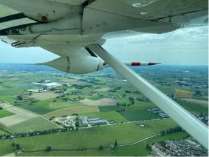
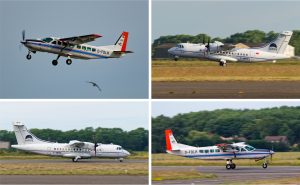
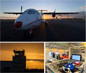
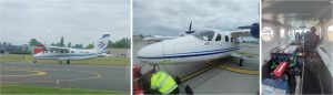
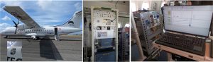
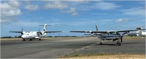
- Three research aircrafts are joining the campaign for more than 200 hours of scientific flight: SAFIRE ATR42, DLR Cessna-Caravan and SSF-Tecnam P2012. Payload will include remote sensing instruments, such as OSIRIS (3MI demonstrator), SCALE (CNES CO2 lidar), Telops Hyper-Cam or SWING, as well as atmospheric samplers such as SPIRIT, or the new IAGOS bay. Coordinated flights are organized to take advantage of the full suite of instruments onboard the planes.
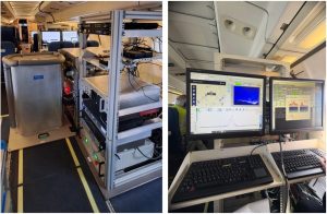
- Ground-based measurements will include: mobile Fourrier Transform Spectrometers operating in the infrared (from the far-infrared, such as FINESSE, to the shortwave-infrared, such as CHRIS), aerosol lidar and photometer, and several lidars measuring gas abundances (H2O, CO2, CH4), wind and temperature.
The team
All together, the campaign involves 21 teams from 5 countries:

- AERIS (CNRS – France)
- AEROLAB/CIEL (CNRS, Université de Reims-Champagne Ardennes – France)
- BIRA-IASB (Belgium)
- CMS (Météo-France – France)
- CNRM (CNRS, Météo-France – France)
- CNES (France)
- DLR (Germany)
- Freie Universitat Berlin (Germany)
- GFZ (Germany)
- Imperial College (UK)
- IPSL (France)
- LAERO (CNRS, Université de Toulouse – France)
- LATMOS (CNRS, Sorbonne Univerté)
- LMD (CNRS, Ecole polytechnique, Sorbonne Université, ENS – France) – lead
- LOA (CNRS, Université de Lille – France)
- LPC2E (CNRS, Université d’Orléans – France)
- LSCE (CNRS, CEA, Université de Paris-Saclay – France)
- SAFIRE (CNRS, Météo-France, CNES – France)
- SFS (Switzerland)
- SIRTA (CNRS, IPSL)
- ULB (Belgium)
Campaign logbook
Thursday 25 June
Today at Lannion, the last meteosonde of the campaign was launched by Hervé Roquet and his wife Pascale, for his retirement party. Hervé is the former Director of the Meteo-France site at Lannion, and this launch was a very nice tribute to his dedicated work at Meteo France. We wish him the best for the future.
The day ended with a sequence of calibration of the Picarro and cleanly end the campaign à Lannion.
Over West Flanders, an audacious measurement scenario was implemented: the ‘Pig study’. Its goal: to study the diurnal evolution of the emissions by the pig farm located at the BEAM site. To reach this objective, no less than seven 30mn-flights of the Tecnam were organized every 2 hours, while the ground-based team spent their day making measurement… in sweltering heat.
Today was also the return flight of the ATR42 from Francazal airport to Calais. For once, it was a regular transit flight of 2h. But it was clear sky for almost the whole flight and a great amount of measurements were obtained for SCALE, allowing the testing of two different configurations (two wavelengths).
Wednesday 24 June
Today, in a very hot weather throughout France and Belgium, a long-awaited scenario was put in place: the long-range validation of Metop-SG-A1, with a full combination of collocated ground-based instruments, ballon launches and aircraft flights. The ATR42 took off from Calais at 9:30 UTC and headed towards Reims and the MDH site for a rendez-vous with Metop-SG-A1 at 10:09 UTC. Joining the party, two balloons were launched from the MDH site: the first one carrying an AirCore instrument for the measurement of CO2, CH4 and CO profiles; the second carrying a POP-C aerosol counter and an ozone sonde. And all this was made while the ground-based mobile instruments from LOA, Imperial College, LMD and CIEL scanned the sky with an aerosol lidar and sun photometer, FINESSE and EM27/SUN spectrometers. An exceptional combination!

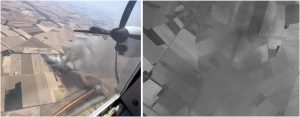
The ATR42 then continued towards the South of France, intending to perform a missed approach at Chateauroux in order to acquire profiles of trace gas concentrations thanks to all the onboard in-situ measurements. Unfortunately, the maneuver was cut short by an intense fire in the vicinity of the airport and the ATC. But the ATR42 was able to perform a few circles around the plume in order to catch the elevated concentration of gases inside the plume… which ended in a bumpy ride for the crew!
Finally, the ATR42 continued towards Aire-sur-l’Adour where, as for Reims in the morning, it met with a balloon-borne AirCore, while CNES EM27/SUN spectrometers acquired measurements from the ground. And overall, no less than 3 AirCores were launched from Aire-sur-l’Adour during the day: two at the overpassing time of Metop-SG-A1 (morning and evening) and one at the overpassing of the ATR42.
The journey of the ATR42 ended at its home, Francazal airport near Toulouse, with a well-deserved night of rest for the happy crew.
Meanwhile, in a much cooler Lannion, two meteo-sondes were released at the passing-by of IASI-NG at day and night.
Tuesday 23 June
After the eventful two previous days, most of the teams took the day off. And once again, the plans for the day were disrupted by the weather and the military operations in Norther Belgium.
The Tecnam had planned to implement a specific scenario above the BEAM side but rain came in. Plan B was again activated: it was a go for survey of West Flanders to study agricultural emissions of NH3 and NO2.
On the balloon side, onie AirCore launch was organized at Reims and two meteosondes were released at Lannion at the passing-by of IASI-NG at day and night.
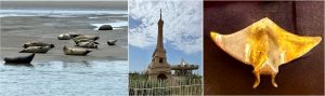
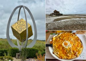
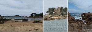
Today marked the ATR42 crew’s final day off before the final stretch of the campaign. To make the most of this day off, the LPC2E team headed to Berck-sur-Mer, where they were able to observe an impressive colony of seals, far more numerous than the crew working on SPIRIT ! Next, they set off for Le Touquet, with its elegant Anglo-Norman-style villas that give the seaside resort its unique charm. A much-appreciated coastal interlude before returning to the tracks and the instruments. And because no day off would be complete without another unlikely zoological discovery, the collection of golden animals was further enriched by an encounter with the very elusive golden ray in the village of Cucq. Following on from the tortoise, the turkey, the snail and the pigeon, the MAGIC-AVALON campaign has definitively confirmed its research focus on metallic wildlife. Batteries are now recharged, the teams are motivated and SPIRIT is eager to get back to work. The team is ready for the final flights of the campaign !
Monday 22 June
Today, for once, absolutely nothing went according to plan! Yesterday’s afternoon briefing had decided on an Antwerp harbour scenario with bith the Tecnam and the ATR42 making a coordinated flight while the MAMS and FINESSE teams came from Lille to perform measurements from the ground in the vicinity. But this was before joined military operations between Belgium and the Netherlands closed the area.
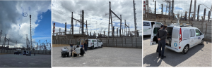
It was a disappointment, especially for the FINESSE team, who had to get up early to arrive on site at the scheduled time, but they found consolation in an excellent day of measurements amid the industrial landscape of Antwerp.
Fortunately, true to the maxim of ‘always staying one step ahead’, Plans B had been prepared! The two planes ultimately headed to West Flanders to carry out a specific scenario: a profiling flight of the Tecnam over the instrumented BEAM site, with the goal of determining the ability of the onboard instruments to measure NH3 and NO2 concentration profiles. The LOA’s mobile MAMS station even managed to arrive on time from Antwerp to take measurements at the BEAM site as the planes flew by.
And the day was not easy on the balloon side neither! Flights had to be cancelled at Lannion, Reims and SIRTA. But the CNES-LMD team at Aire-sur-l’Adour managed two unexpected AirCore flights, including one in the evening, with an analysis that ended at 1:00am local time! Another proof of the strong variability in weather conditions and the forecasts.
All in all, it was a great day of measurements, despite some organizational headaches.
Sunday 21 June
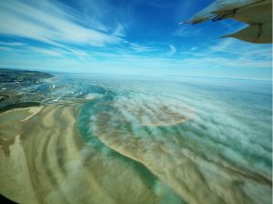
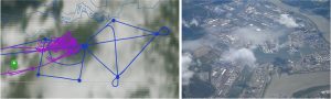
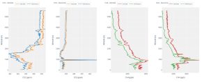
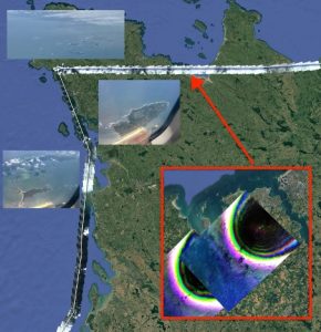
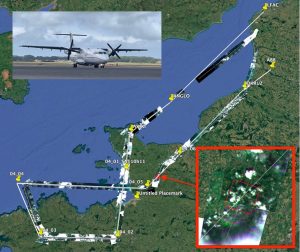
Today, the ATR42 and the Cessna-Caravan performed a spectacular wing-by-wing flight! For about six minutes, both aircrafts sampled the same air mass along a common flight path South-West of Calais, in order to compare and harmonize their respective in-situ instruments, an essential step to enable the joint exploitation of the data for satellite validation activities or emission studies. Many thanks to the pilots for this very precise and smoothly executed manoeuvre! This gave also both crews the opportunity to take stuning pictures of the other aircarfts. And first quicklooks from both teams already show a strong gradient in CO₂ and CO, with increasing concentrations from southwest to northeast along the shared flight track.
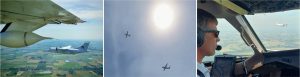
Both aircrafts then continued their own measurement, all in VFR. An usual flight for the Cessna, but quite an impressive manoeuvre for the bigger ATR42! In a coordinated approach, the Cessna made its final mission flight over the Dunkirk industrial area while the ATR42 studied the downwind evolution of its plume. Over Dunkirk, a pronounced land–sea breeze circulation had been forecast and was clearly visible in the measurements from the Cessna: enhanced CO₂ and CO were observed south of the industrial area at lower altitudes, while elevated concentrations were detected northwest of Dunkirk over the sea above about 2000 ft. In the South, high concenterations of CO, CO₂ and O3 were measured as far as 40 km from Dunkirk industrial site. A second plume along the coast line was also found, stemming from a shift in the wind direction throughout the day. Being in VFR allowed the pilots to adjust in real-time the aircraft trajectory based on onboard measurements, which helped the happy scientific crew to acquire essential data to reconstruct the evolution of the plume. And it gave breath-taking views of the coast line and the cities
After landing, the ATR42 made a one hour break before taking-off again, this time to fly at FL180 over Dunkirk industrial site. The weather conditions were ideal and allowed for the best measurements of SCALE so far, both other land and ocean. And the landing path provided a new opportunty to probe the emission plume from the industrial site.
Quite an eventful day that perfectly concluded the Cessna mission in Calais. The DLR team immediately started packing to prepare their two transfer flights that will bring the team back to Germany on Monday. Thanks to the DLR team for the excellent joint measurements and have a good trip back!
Saturday 20 June
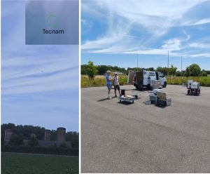
Today destination is Antwerp… with the 3 research aircrafts, SAFIRE ATR42, DLR Cessna and SFS Tecnam, all deployed over the city and its harbour to study the anthropogenic emissions of greenhouse and trace gases…

Two AirCore launches were also organized today: one in Aire-sur-l’Adour and the other at the MDH site of Reims. After inflating the balloons, the flight chains were released and carried their respective payloads. About 3 hours later, the instruments landed under their red parachutes in two easy locations, witnessed in Reims by white and black cows. That’s two more profiles of gas concentrations to validate satellite observation from IASI-NG and Sentinel-5, both onboard the Metop-SG-A1 satellite!
Friday 19 June
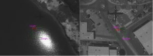
Friday turned into a golden day for satellite validation during MAGIC-AVALON: the three aircrafts returned to Belgium West Flanders to precisely target one IASI-NG field-of-view (FOV). And the rendez-vous was perfectly executed with the 3 aircrafts inside the FOV at the exact overpassing time of Metop-SG-A1, providing a well-coordinated multi-aircraft dataset together with ground-based observations at the BEAM site.
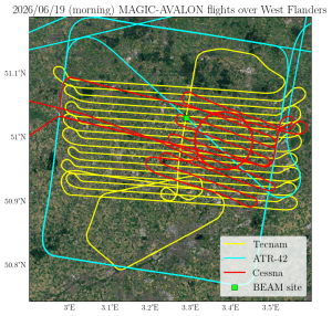
Indeed, the FINESSE, LOA, and the ULB teams all deployed to the BEAM site. Measurements were taken from a height of 7 m using a scissor lift. This allowed for emissivity measurement by FINESSE, which has the advantage of being able to make up or down observation. A perfect complement for the FOV characterization. And while being up there, the team spotted the DLR Cessna and the Tecnam flying over the farm. A great thanks to ILVO for helping move the heavy instruments unto the scissor lift.
The atmosphere did play along, with clear conditions and a well-defined boundary layer and inversion structure that allowed measurements both inside and outside the mixing layer. Within the boundary layer, where the Cessna flew, turbulence and thermal structures produced correlated variations in methane and water vapor, making the dataset promising for eddy covariance analysis.
In the afternoon, the ATR42 and Cessna continued with a second flight to Ghent. While the ATR42 flew its classic square pattern at FL180, the Cessna chose a mass-balance pattern over the industrial area around the steel and fertilizer plants. Clear plume structures were sampled with the in-situ instruments. The SCALE team benefited of these new flights to perform additional measurements in the area that will be useful to compare the results obtained over the same place with different instrumental configurations promising great data exploitation!
In Lannion, two radiosoundings were performed today at both over-passing times of IASI-NG at 10:04 and 21:32 UTC, following the plan to gather as much data as possible for the validation of the instrument.
Thursday 18 June
What an exceptional day today!! At last, thanks to a vast improvement of the weather, and the coming of a new heat wave over Western Europe, today was a cloud-free day in Belgium, allowing the simultaneous deploiment of the 3 research aircrafts involved in the campaign. Their target: a IASI-NG field-of-view (FOV) located in West Flanders, close to the BEAM supersite. On the menu: a profile and a raster pattern by the Cessna, a surrounding box by the ATR42 and multiple straight lines for the Tecnam, all at the overpassing of Metop-SG-A1 at 10:23 UTC. The FOV location was predicted by EUMETSAT operational team and allowed to design specific flight plans.
The ATR42 and the Cessna started their flights with a view of beautifully structured cloud fields along the coast. And while trace gas concentrations measured by the instruments onboard the Cessna in the West Flanders were, as anticipated, relatively low and uniform, the most noteworthy aspect of the mission was something else: for the first time during the campaign, all three aircraft were operating in the same area simultaneously enabling coordinated observations. Nice!
In addition, the mobile ground-based team from LOA and Imperial College deployed their instruments at the BEAM site and inside the FOV in order to acquire spectra that will be compared to those acquired from space. The ULB team also deployed to the BEAM site to conduct NH3 measurements using their Hypercam Nano instrument. While on site, they observed the DLR Cessna and the Tecnam aircraft overflying the farm en route to validate the IASI-NG FOV.
Following a pleasant and well-deserved lunch break on the airport restaurant terrace 😊, the ATR and Cessna team took off for an afternoon mission towards Ghent. The goal was to revisit the industrial area and sample the emission plumes under meteorological conditions different from those encountered during earlier flights. The atmosphere once again provided an interesting view shortly after take-off. Near Dunkirk, a very strong and unusually low inversion confined emissions to a narrow layer close to the surface, offering an impressive real-world example of how strongly atmospheric conditions can influence plume transport and dispersion. This second combined flight between the ATR and the Cessna was a huge success and provided an excellent day of measurement for SCALE! The sky over Belgium was clear and the instrument managed to acquire a lot of data in West Flanders and around Ghent. Special thanks to the pilots who made us fly right over the steel factory. No doubt the data analysis will be interesting!
Meanwhile, in Lannion, the team focused on making radiosoundings balloons at the overpassing time of IASI-NG in the morning and in the evening. The evening launch was particularly beautiful with foggy conditions making the balloons rapidly disappear from sight few seconds after the launch.
Wednesday 17 June
Today, it was definitily the “premieres” day, with the first flight of the Tecnam, as well as the first ever AirCore launch from the SIRTA site in Palaiseau.
To begin the day, two flights were planned for the ATR42 while DLR enjoyed a day off. The first flight took off from Calais to rendez-vous with MicroCarb at 10:42 UTC over Reims, where an AirCore was launched and the mobile ground-based team was deployed. The weather was good in Reims over the morning but clouds arrived just before the expected overpassing time of the satellite. Nonetheless, a few holes in the cloud allowed to briefly see the ground from the ATR42… or the aircraft from the ground!
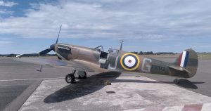
After going back to Calais, the ATR42 landed in Calais and it was the occasion for teh crew to enhoy a good surprise: the presence of a World War 2 “Spitfire” that was making a stopover in Calais airport!
After enjoying a brief rest, the ATR42 crew took of again for a new destination: Dunkirk. This times, the flight offered clear sky around Dunkirk. On the SCALE team, Hugo and Dorian, which were back on board the ATR42 “SpitLaser”, were happy to perform measurements above land and sea and test SCALE over an active source of CO2 in excellent weather conditions.
And today marqued the first test flight of SFS Tecnam as part of the campaign. Processing chains were set up to analyse the spectra recorded by the SWING and Telops Hyper-Cam imagers, which gave the first quicklook images of NO2 and NH3 over the region.
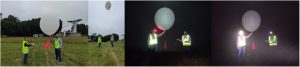
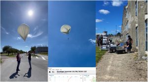
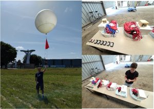
And the day ended with an event planned carefully for several months: the first ever launch on an AirCore from the SIRTA site located at the campus of Ecole polytechnique in Palaiseau at 20:21 LT. An evening flight, perfectly executed and in agreement with the simulated trajectories, which even allowed the team to attend the landing of the AirCore after its descent. A great success for the LMD team.

The profiles of CO2 and CH4 concentrations will be used to validate the gas column measured from space… but also from the ground by 2 lidars developped at LMD : COWI and MEDAL lidar systems integrated on the same experimental platform, which provided their first simultaneous measurements. COWI retrieves CO₂ concentration and wind profiles, while MEDAL retrieves CH₄ concentration profiles.
Tuesday 16 June
Today’s DLR Cessna mission combined measurements of CO₂ emissions from the steel plant with observations of N₂O emissions from a fertilizer plant, an emission source that had been identified during one of the earlier flights. While the boundary layer was strongly capped and offered only limited visibility within it, conditions above were exceptionally clear.
One particularly interesting observation was that the CO₂ plume, likely driven by its higher temperature, appeared to overshoot the boundary layer and extend into the free troposphere. The nearly cloud-free skies also provided excellent conditions for the Tecnam aircraft, which joined the mission to investigate NH₃ emissions from the fertilizer plant together with the DLR Cessna team. Very nice!
Meanwhile, in Lannion, the campaign team welcomed a visit of the AERIS board, who were introduced to the instruments and all the installation made to perform balloon launches and analysis of the air with the AirCore. The AERIS team has a direct contribution to the campaign, with the development of the operational website and the archiving of campaign data for further distribution. We also had the visit of Samuel Zbynovsky, a weather passionate and self-made podcaster and Youtuber, to have a better look at the operation at Lannion for the campaign, to further produce an interview of our activities on site. Finally, the team reconfigured the flight chains for the upcoming launches.
After these last intense days of measurements, it was time for a well-deserved day off for the ATR42 crew. The LPC2E team decided to explore Lille, on the home turf of our colleagues at LOA. A perfect opportunity to recharge our batteries before the rest of the campaign. The collection of golden animals also continues to grow. After the tortoise, the turkey and the snail, the team today came across the very rare golden RouRou (pigeon). The scientific community is still struggling to explain this strange concentration of golden species in this region. Finally, in a world exclusive, the LPC2E team is proud to present their brand-new looping indicator integrated into SPIRIT. The principle is simple: « If the eyes are looking upwards, the aircraft is flying upside down. » Combining cutting-edge science, unlikely ornithological discoveries and instrumental innovations, the MAGIC AVALON campaign continues its adventure, full of surprises as ever.

Monday 15 June
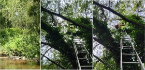
Monday was the aftermath of the ‘golden day’… and some things had to bet aken care of in Lannion. Indeed, the first AirCore flight of the day before landed up high inside a tree. The recovering team had the opportunity to take the AirCore back in a hurry, but had to leave part of the flight chain (the separator and the parachute) which was stuck even higher in the trees. The LMD team attempted recovering this part, in a very natural and interesting experience. Crossing a river with a stair, a telescopic pole and all the safety equipment was definitely an experience!
In Calais, the bad weather forced cancelling the flight for the ATR42. The DLR Cessna team took this opportunity to conduct a scouting flight over the western Flanders region. To prepare for the upcoming missions scheduled for the final week of the Cessna deployment, three different flight patterns were combined within a single flight. A raster pattern and a spiral were flown close to the Beamsite to evaluate how the IASI-NG field of view (FOV) can best be replicated by aircraft observations. Afterwards, a box pattern in the southern part of the ATR western Flandern box was flown to test the feasibility of estimating agricultural emissions using eddy covariance analysis. In contrast to most previous flights, the observations were not characterized by sharp greenhouse gas peaks, but rather by variability occurring over larger spatial scales.
©A. Reuther
Sunday 14 June
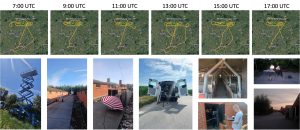
What an exceptional day!!! On the last day of IRS measurements before a one month and a half outage due to the repositioning of MTG-S on its final position, we were lucky enough to finally perform the scenario envisioned for its validation. An the summary of the day is stunning: 10 balloons launches and 4 aircraft flights during the same day. An overall achievement for the team.
At Lannion, after the first ever launch of an AirCore on the 12th of June, it is not one, nor two, nor three, but four AirCore launches that were performed in the same day at Lannion. The first and last launches were coordinated with the overpass of Metop-SG-A1 and Metop-C during their one-but-last day of the tandem flight. That last flight leading to night recovery, with the team guided by the lights placed on the AirCore bax. A fantastic team work between CNRM, CMS and LMD!
And the day was also exceptional at Aire-sur-l’Adour where the joined CNES-LMD team achieved 3 launches of AirCore, with again the first and last day at the overpassing time of Metop-SG-A1. Unfortunately, strong wind at the surface prevented the team to launch the 2nd scheduled AirCore.
Finally, in Reims, even if the simulated trajectories prevented launching AirCores, the AEROLAB team was able to perform their first balloon launches from Reims since the start of the campaign, with three radiosondes launched throughout the day (a moment the team had been eagerly waiting for!). During the second launch, the balloon even reached a maximum altitude of 42,501 m, setting a new altitude record for a high-altitude balloon launched from the MDH-Reims site!
The CIEL-AEROLAB team was also pleased to welcome on the campus of Reims the ground measurement teams from LOA and Imperial College London for a beautiful sunny day. Under great meteorological conditions, the team deployed FINESSE, CHRIS, EM27 and MAMS spectrometers allowing for the full coverage of the thermal infrared spectrum, from the short-wave to the far infrared. Thanks to the operational EM27/SUN continuous measurement at the University of Reims-Champagne Ardennes, it will even be possible to intercompare the measurements made by the fixed and mobile EM27/SUN spectrometers. Having two of the three meteo sondes launched while the spectrometer were making measurements also adds a great flavor to the day, since having collocated profiles of temperature and humidity will greatly help the processing of the acquired spectra.
And the day was no less exceptional for the aircraft teams. Thanks to 4 coordinated flights between the ATR42 and the Cessna-Caravan, we were able to extensively study the gas plume from Dunkirk industrial site. Due to southerly winds, the plume was entirely going in-land. And so an ambitious scenario was put in place at a last notice. First, the Cessna-Caravan took off from Calais to reach Baudelet, flying several legs along the way at 1,500 ft. An hour and a half later, the ATR42 took-off from Calais to fly the same pattern, but with additional legs, and at the same altitude of 1,500 ft !! A VFR flight for the heavy ATR42, in a busy sunny Sunday, surrounded by a lot of smaller aircrafts. A bumpy flight but, for once, the in-situ instruments team were thrilled! They were finally able to catch signals on several gases (CO2, CO, CH4, N2O), with even impressive values far from the point of emission.
Both aircrafts then landed in Calais and waited one hour before taking-off again to go this time to Dunkirk, with the Cessna-Caravan flying again between 1,000 and 3,000 ft above Dunkirk industrial site, while the ATR42 flew its pattern at FL180. The objective: to complete the survey of the plume and demonstrate the capacity of SCALE onboard the ATR42 to detect the plume. The start of the flight was clear sky, and some measurements were obtained above sea and land around Dunkerque. A first leg close to ArcelorMittal enabled some measurements over the plume and promises a good test-case for the processing algorithms!
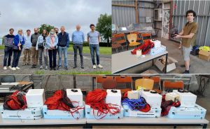
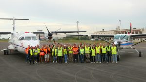
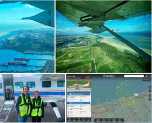
To celebrate this exceptional day, a team picture was taken at Calais in front of the two aircrafts. A team of 44, mechanics, pilots, scientists, modelers – all united to reach the objectives of the campaign.
And to thank the involvement and dedication of the team, a mid-campaign diner was organized at the great airport restaurant, le vol au vent, in a very friendly (and yellow 😉 ) atmosphere. The occasion also to celebrate the (potentially) last campaign of Hubert, who has been with us since the first MAGIC campaign in 2018! Thanks buddy and see you around!
Saturday 13 June
Today was a day-off for most of the teams…
…Except for the joined Meteo-France/LMD team which organized another meteo sonde launch at Lannion at the over-passing of IASI-NG and IASI-C, preparing also the activity of the next day for the “golden day”, with 4 AirCore flights expected.
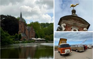
The LPC2E team was delighted to welcome back their lab director, who came to oversee operations and, above all, to offer his support to the team working on this campaign. It was a visit that was always appreciated after several days away from the lab. The day also provided an opportunity to discover some of the gems of the Belgian coast, with trips to Bruges and Ostend. A stop in Nieuwpoort allowed us to witness an astonishing exhibition combining Volkswagen Combi and kites, much to the delight of onlookers. Finally, after the golden turtle and then the golden turkey, the collection has been further enriched with the discovery of a golden Bavouille (snail). At this rate, the team might soon open its own metallic zoological inventory! Between science, team bonding, and local explorations, this MAGIC AVALON campaign continues to hold plenty of wonderful surprises. Now we just have to wait and see which golden animal we’ll come across next…
Friday 12 June
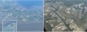
Today, a fully overcast day over most of northern France with a hole just above Brittany… Ideal conditions for the first AirCore launch in Brittany ever and for performing a validation of 3MI and METImage onboard Metop-SG-A1! In Brittany, benefiting from all the meteosonde launches since the beginning of the campaign, the first ever AirCore launch at Lannion and during the MAGIC-AVALON campaign was made. And it was a perfect collocated measurement with the passing-by of IASI-NG, IASI-C and the ATR42. Thank you to the joined team of Meteo-France and LMD for this great achievement!
Concerning the ATR42, its 11th science flight gave us a fantastic opportunity to perform validation of 3MI and METImage cloud products with extended low liquid clouds all around Bretagne and many ship tracks that had developed over the Rail d’Ouessant where about 70% of the worldwide ships traffic (in tonnage) pass by every year. Observing ship-tracks using multiangle polarization provides a very precise way to determine droplet size distribution and better understand clouds-aerosols interactions.
Some interesting results were also obtained for SCALE. The beginning of the flight at FL200 was a little bit limited for the instrument, with low intensity ground echo obtained. However, good results were obtained during the flight back from Vannes to Caen over land and then from Caen to Le Havre over sea at FL180. During the cloudy areas of the flight, SCALE operators enjoyed the shared snacks with the other teams with a beautiful view and Breton music.
Thursday 11 June
Due to low cloud coverage forecasted by all NWP models in the morning over Western Belgium, today was a day of early departure for several teams!
And it was worth it, with an excellent ATR flight for SCALE! No low / medium clouds over Belgium (Ghent and Antwerp). The ArcelorMittal plume was quite visible from the aircraft and perfectly located to allow the ATR42 to cross it several times. Attenuation seems to be observed from the Lidar measurements quicklook, which confirm that large CO2 concentrations were indeed detected, the exact value to be confirmed after further data analysis.

The Cessna team decided to target the Baudelet landfill for a second time. An analysis of the data from the previous flight showed that the structure of the plume measurements was very inconsistent in time and place most likely due to convective weather conditions. Therefore, a new flight pattern was planned and completed to gather more data of the plume for a statistical analysis. Furthermore, the ground team was trying to follow the patterns of the DLR Cessna to increase the available data set even more. As this time the measured emissions were inconsistent once more, the more statistically focused patterns proved to be a good choice.
©G. Rüdinger
Meanwhile, hoping for some clear sky conditions, FINESSE team set up at the BEAM site in Pittem on the Pig farm alongside CHRIS and the EM27/SUN. We got some measurement with cirrus clouds, until lower cloud came in so we packed up.
The ULB team went to Kortrijk Airport to perform tests on the Telops Hyper-Cam together with their partner, Thomas Rutz, from Freie Universität Berlin (FUB). They also took the opportunity to meet the SFS pilot crew operating the Tecnam P2012. Good news: the tests were successful! Thomas, the Hyper-Cam, and the SWING instrument from BIRA-IASB are all in good hands.
Finally, on the West side of the campaign in Lannion, the operational team discussed the future AirCore flights, with programming of a scenario of operation for a “golden day”, expecting 4 launches of the AirCore instrument in a single day to perform the validation of MTG-S/IRS. The team defined two teams to alternate every two launches for the activities of launching, tracking and recovering the instrument to bring them back for analysis to Météo France site.

Wednesday 10 June
Today, the teams have pushed the boundaries of what is possible in terms of time coverage!
In search of clear-skies the FINESSE team based themselves on the rooftop at the University of Lille to make measurements throughout the night from Tuesday to Wednesday. Conditions were generally helpful, with a mixture of clear-skies and overhead cirrus cloud – excellent for testing agreement between lidar observations of the cirrus vertical location and optical depth, microwave measurements of the temperature and humidity structure and the downwelling radiance spectra captured by FINESSE.

For the ATR team, the day began at dawn, with a (very) early start at 3am local time to start warming-up the instruments. The target: to take-off at 6 :00 UTC to go to Belgium and scan the Ghent and Antwerp regions. The scientific obectives are studying the industrial emissions from both regions, as well as provide data for the demonstration of SCALE. For once, weather was not that bad, especially over Antwerp early in the morning, where many holes were found between the low clouds.
Long field campaigns are also punctuated by tasks that are a bit less spectacular but just as essential: today, the laundromat was an integral part of the scientific program for the SPIRIT team. Between flights, maintenance must be carried out—for both the team members and the instruments!
Tuesday 9 June
Today, the first combined flight between SAFIRE ATR42 and DLR Cessna-Caravan took place over the Ghent region in Belgium. The goal was to capture the emissions from Ghent industrial sites, while testing the possibility to perform collocated measurements between the two aircrafts allowing for the combination of the instruments flying on each aircraft. And it was a success with a perfectly timed rendez-vous point over the “GAN2” point, just in a giant cloud hole in an overly overcast region. A perfect rehearsal for a future combined flight with all instruments operating onboard. At the same time, the ground-based team from DLR performed some measurements in Ghent. The ATR42 continued then to the Antwerp region for a star-square pattern. A great thanks to Belgium ATC for allowing us the possibility to fly this pattern.
Higher up, the 4th radiosonde was performed at Lannion, with an exceptionaly long flight.
Monday 8 June
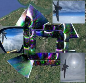
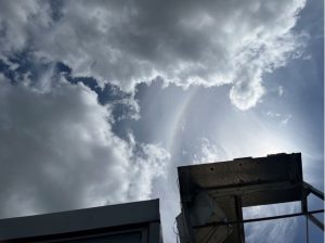
Today, the 4th MAGIC-AVALON Science Flight headed to Ghent for a short test flight aiming at preparing the future flights over Belgium. The aircraft encountered very peculiar flight conditions, flying between two very homogenous cloud levels. Mid-level liquid clouds just below the ATR-42 showed psychedelic colors when observed in polarized light and thin cirrus above exhibited a nice halo around the sun. In the end, and quite unexpectedly, a perfect test case for validation of 3MI and VII multilayer detection and retrieval algorithm, as well a good case study to look at synergy between IASI-NG and 3MI.

Regarding in-situ instruments onboard the ATR42, some more great data were acquired, allowing for the comparison between the new O4C instrument from AEROLAB and the Picarro, yielding an excellent agreement, albeit a bias as expected for uncalibrated data. An impressive result for such a new instrument as O4C, given it is its first deployement in an aircraft campaign! As a bonus, a plume was observed during the descent towards Calais, as we flew over Dunkirk.
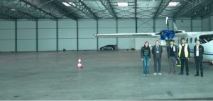
The Tecnam P2012 was relocated from Switzerland to Belgium. It safely landed in Kortrijk (Belgium) around 1pm! All instruments ready for the campaign and a first test flight tomorrow.
Meanwhile, in Lannion, flight chains were prepared and tested for the upcoming AirCore flights. The joined CMS-CNRM-LMD team is eager to start the launches!
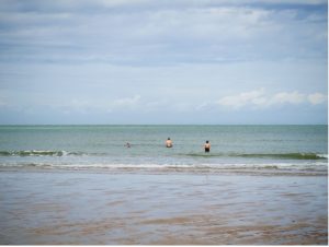
The DLR team was on their second off day of the campaign. It was time to recharge the batteries prior a busy second week of the campaign. After recovering a bit of sleep the day started with a quick refreshing dip in the Atlantic Ocean followed by a walk along the cliffs of Normandy. In the evening a fish restaurant in a nearby village was chosen for a delicious dinner. Afterwards the planned flights for the upcoming days were discussed. As there were still some preparations necessary for the morning flight planned for the next day like refilling the calibration gas bottles and changing the filled Flasks of the JAS sampler everyone went to bed early to get some rest.
(©G. Rüdinger)
Sunday 7 June
Today saw the first incursion of the MAGIC team to Belgium, with the DLR team deployed the Cessna and its ground-based mobile team to the region of Ghent. The objective: to study the emissions of CO2, CH4 and CO from the industrial sites located there.
Enjoying the second day-off for the ATR crew, the LPC2E team had a chance to continue exploring the magnificent Opal Coast between Cap Gris-Nez and Boulogne-sur-Mer. On the agenda: seascapes, fresh air, and a few unusual discoveries. After encountering the famous golden turtle of Nieuwpoort during the previous day off, the team came across a new remarkable specimen today: the golden Glou-Glou (turkey). The scientific mission has not yet determined whether it belongs to the same species as the turtle, but investigations are ongoing. On the culinary front, the team embarked on a local culinary experiment by sampling a Welsh rarebit reimagined as a pizza. The results are promising, though further testing will likely be needed to confirm the findings. A day marked by discovery, before SPIRIT’s imminent return to its favorite element: the sky !
Meanwhile, in Lannion, the LMD team discovered the town centre of Lannion and visited the Church of Brélévenez. Ending the day with a nice encounter with Dolmens and Menhirs near the coast.

Saturday 6 June
After a good night rest in the hot weather of Toulouse, the ATR42 crew headed back to Calais, following a flight path over the Atlantic Ocean. Excellent atmospheric conditions allowed were encountered from the Gulf of Gascogne up to the Morbihan, allowing for great data acquisition for both OSIRIS and SCALE. The flight gave a great opportunity to observe extended low cloud cover over the Atlantic and Normandy with their characteristic cloud bows showing in the OSIRIS polarization image. In addition, clear sky conditions off the southern coast of Morbihan provided nice views of a few iconic islands: Hoedic, Houat, Belle-Ile-en-Mer, Groix and Les Glénans.
In particular, the analysis of the data acquired by SCALE over the sea, at two different levels (FL180 and FL200) data will be very useful to better understand the behavior of the instrument above the water.
The weather was not the same in Calais, with rainy and gusty conditions. Saturday was thus chosen by the DLR team as another ground day. The calibration gas for the MIRO Instrument was refilled and the sampled flasks of the JAS Instrument were exchanged with new empty ones. As Ghent was decided as a new target area for the double flight of DLR Cessna on Sunday, a lot of flight planning was also done: A steel fabric, chemical industry and the city plume were chosen as targets for the morning flight. For the afternoon it was decided to practise a new flight pattern on one of the targets which will play an important role in the satellite validation later in the campaign. The accompanying ground team did a lot of planning as well to find the best spots for supportive measurements close to the targets in the densely populated area of Ghent.
(©A. Reuther)
Meanwhile, the team in Lannion enjoyed a picnic along the “Côte de granit Rose”, in intensely windy weather, but with a magical spectacle for the eyes.
Friday 5 June
Friday was a very productive and could even be qualified as a test bed for a future ‘golden day’. It included two aircrafts in the air, first deployment of the mobile ground-based platforms and balloon launches, including rendez-vous points with satellites!
The ATR team had an early start at 5:30 am to start heating the instrument. This was followed by crew briefing and take-off at 9:00am. The objective: flying form Reims to Aire-sur-l’Adour following the Metop-SG morning orbit, included a missed approach at Chateauroux airport to acquire profiles from all in-situ instruments. Unfortunately, due to cloudy and windy conditions, all planned balloon flights at Reims and Aire-sur-l’Adour got cancelled, preventing from comparison between SCALE measurements and these external data. Nonetheless, the flight was a good opportunity to test various configurations for the lidar and be ready to experiment more on the return flight. The ATR track allowed for good acquisition of OSIRIS, demonstrator of 3MI.
In the North, two more flights of DLR Cessna were executed to the Dunkirk industry region: one in the morning and one in the afternoon. The airborne measurements were again accompanied by ground measurements from DLR but this time, thanks to a better weather than in the beginning of the week, they were joined by the mobile platform from the joined LOA and Imperial College teams. From the analyzed data of the previous Cessna flight and ground measurement in this region on Tuesday the team was able to work out the most interesting measurement sites and improve the flight pattern of the DLR Cessna. As there were no problems with the instruments and even a working weather station was added to the DLR ground measurements, the team was very happy with this very smooth campaign day.
Last radiosounding balloon at Lannion before the week-end, for the first time with great conditions on ground. The team had to delay the flight due to an upcoming plane at the Airport. The “go” was called when the Control Tower at the Airport had the plane on ground.
All together, a very productive day, with lots of data to be analyzed. It was time for restfull evening in Calais, Lannion, Lille, Reims and Toulouse!

Thursday 4 June
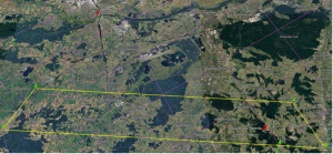
Today, the first flight of the ATR42 took place. Its objective: validating the 3MI instruments onboard the Metop-SG-A1 satellite, and also contributing to the demonstration of ECO and SCALE future space missions. To reach this objective, an ambitious scenario was put in place: flying to Brittany to rendez-vous with no less than 2 satellites, Metop-SG-A1 at 10:12 UTC over the Cotentin region, and then CO3D at 11:23 UTC. The latter requesting an exact collection in time and space, in a rectangle of 7×20 km2. And, thanks to a carefully planned flight and amazing last minute change due to some incoming traffic, both rendez-vous were met at the exact time and place!
Onboard the ATR42, all instruments worked nominally and allowed for a great gathering of data.
On the menu for the OSIRIS/LOA team we had a “rendez-vous” with Metop-SG-A1 at 10h12 UTC over Normandy for 3MI validation, a tour over Bretagne du Nord and Lannion for ECO Earth Explorer 12 demonstration and more 3MI validation, and finally another meeting point at 11h23 UTC with the CO3D mission for C3IEL demonstration.
This flight also marks SCALE’s first acquisition over the sea! Weather was mainly cloudy, but some limited clear sky pattern allowed to notice a low amplitude signal.
The flight was also the first flights for the O4C instrument. This greenhouse gases sensor was recently developed at AEROLAB, as part of the Equipex+ Obs4Clim project. The O4C instrument was fully operational: measurements were recorded correctly throughout the flight. Despite a slight delay at start-up, which resulted in a shorter warm-up time, the initial data show good agreement (CO2, CH4 and H2O) with the Picarro reference instrument, which was operating on the same sampling line.
Finally, the second launch of a radiosounding balloon at Lannion was performed at the overpassing time of Metop-SG-A1. The dedicated team worked in collective intelligence to perform their first flight in complete autonomy. It was a success, despite the heavy wind at ground.
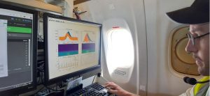
And for more results from the campaign, please see our quicklook page here.
Wednesday 3 June
Today is the first day-off for the aircraft crews. They could enjoy the beautiful surroundings of Calais… and experiment the strong wind and nice rain of the ‘Côte d’Opale’. On the agenda of the LPC2E team: a trip to the coast via Dunkirk, then on to La Panne and Nieuwpoort. Among the day’s discoveries was a surprising golden turtle spotted in Nieuwpoort. The traditional Belgian chips were also subjected to rigorous scientific scrutiny and passed all quality tests with flying colours. A convivial day that allowed us to recharge our batteries before operations resume. For the next day off, however, we suggest adding a simple criterion to the specifications for rest days: a little more sun and a little less rain !

Meanwhile in Lannion, where rain was also coming hard, the LMD team worked on finalizing the preparation of the flight chain for the AirCore flights, including the final tests on the separator (which cuts the rope between balloon and parachute), that will separate the balloon from the rest of the flight chain at a programmed altitude, allowing for an easier separation than when the balloon explodes.
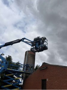
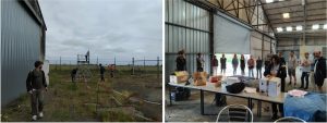
The FINESSE team visited the BEAM site in West Flanders in preparation for deployment there next week. Lieven, Martin and Lorenzo were very helpful in showing us around including a quick training session on the scissor lift and a demonstration of some of the exciting instrumentation that has been deployed around the farm.
The afternoon briefing meeting confirmed the aircraft flights for tomorrow. Objective: Brittany!
Tuesday 2 June
Despite a rainy start, today saw a great improvement in the weather, leading to the first airborne measurements of the campaign.
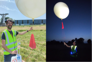
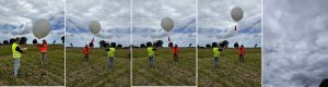
In Lannion, the first meteo sonde launch took place at 10:43 UTC under a beautiful blue sky. After inflating the balloon and coordinating with local authorities, the CMS-CNRM-LMD team release the balloon carrying an M20 sonde in order to measure profiles of temperature, humidity and wind. The launch was organized to organize a rendez-vous with the Metop-SG-A1 satellite that was scheduled to flyby the region at 10:42 UTC.

In Calais, at 13:00 UTC, DLR Cessna-Caravan took-off for its first flight. Its target: Dunkerque. The strong West wind made ideal the conditions to catch the plumes of gases emitted by the various industries found along the coast there. A specific pattern was thus design to fly several legs perpendicular to the plume at various altitudes. The in-situ instruments on-board quickly confirmed large enhancements of methane, carbon dioxide and carbon monoxide at the forecasted location of the plume. A ground-based team from DLR also took this opportunity to deploy an AERIS instrument performing measurement of methane and ethylene at a few meters above the ground. Here again, a large enhancement of methane (~1.2 ppm) was observed.
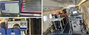
The last checks of the instruments inside the ATR42 were organized and gave the opportunity to our ESA campaign manager to discover the whole suites of instruments available in this flying laboratory.
Meanwhile, in Lille, training of the team to deploy the MAMS mobile platform continued with the presentation of CHRIS SWIR-MIR interferometer. The team is now ready to deploy any days… when weather allows.
Undeterred by the slightly pessimistic weather forecast, the FINESSE team captured measurements at the same time as a Metop SG-A1 satellite overpass at 10.38 pm. While the overhead conditions didn’t quite play ball we had some beautiful views of the sunset, Venus, Jupiter and the reflections of the LOA lidars from the cloud base!
Finally, in Belgium, the mini-DOAS instrument from LATMOS was successfully installed at the BEAM site.
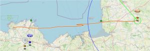
Regarding the plans for the next few days, based on weather and satellite trajectory forecasts, the decision was taken to have a day-off on Wednesday, especially for the aircraft teams, before performing a succession of no less that 3 measurement scenarios the following days. On Friday, the plan is to have the ATR42 and the Cessna-Caravan flying back-and-forth between Calais and Brittany, in order to rendez-vous with Metop-SG at 10:12 UTC over the Cotentin region and specifically validate 3MI observations. Then, on Friday and Saturday, the ATR42 will make an ambitious tour de France by flying under the Metop-SG track from Calais to Aire-sur-l’Adour on Friday and then between Aire-sur-l’Adour and Lannion and back to Calais on Saturday.
Monday 1 June
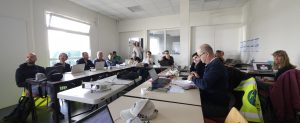
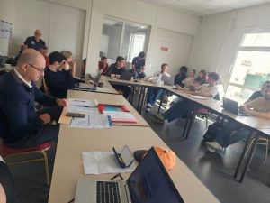
Today was the official start of the campaign with the first daily briefing meeting at 9:30. The occasion to welcome all participants in Calais, Lannion, Palaiseau, Aire-sur-l’Adour, Reims, Bruxelles and Switzerland. No measurement was planned today to allow the teams to arrive on site and install all the equipement.
Today was also training day! In Lannion, CNRM organized a full balloon launch training on the CMS site. The occasion to learn how to operate meteo sondes, inflate balloons and follow the extensive security procedure. Julie Capot (CNRM, France) installed the antenna for receiving the signal of the M20 radiosounding device, which will fly fly under meteorological balloon, either with an AirCore or on its own.
In Lille, the afternoon was devoted to finishing the installation of the mobile instruments (Plasma, Lidar, Photometer) in the car. A training session was then organized to show their operation to all the LOA staff involved in the campaign. And FINESSE, the MIR-FIR interferometer from Imperial College performed its first measurement!
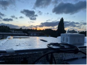
The Imperial College team set up their ground-based FINESSE (Far INfrarEd Spectrometer for Surface Emissivity) instrument on the roof of the Laboratory Optical Atmosphérique at the University of Lille. FINESSE can measure the spectrum of downwelling energy emitted by the overlying atmosphere every few seconds, allowing us to see the energetic influence of rapid changes in temperature, water vapour, cloud cover and cloud type. Conditions transitioned from being relatively clear in the early morning to more complex combinations of cirrus, fair-weather cumulus and clear skies in the early-mid afternoon (see photo below), all of which will be fun to explore with the FINESSE observations.
Our Belgium collegues from the BEAM project and one team from LATMOS continued the installation of the suite of instruments deployed in West Flanders at the BEAM site located in a pig farm in this agricultural region. First measurements are planned in Thursday… if weather allows.
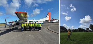
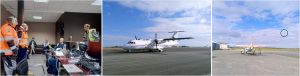
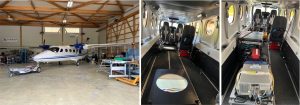
In Calais, we welcomed five students from Lille University who visited the installation and got the full tour of the ATR42 in the morning, with SAFIRE team guiding them through the numerous instruments installed onboard.

Later in the afternoon, DLR Cessna-Caravan in Calais landed at 14:10 CEST and joined the already stationed ATR42 from SAFIRE. The Cessna was transferred from Oberpfaffenhofen to Calais. After 1.5 hours an intermediate stop was made in Saarbrücken for refueling purposes. As the weather conditions were sunny with a few clouds, the flight was very calm. During the flight the opportunity to measure extra data and gain more experience with the Miro and Picarro instruments was seized. During the flight a problem with the Miro instrument occurred which meant that only measurements with the Picarro instruments were possible.After landing in Calais the plane was pushed into the hangar which had been prepared in the morning. The issue with the Miro instrument was fixed in the hangar as well so everything is set for a successful campaign.
Both aircrafts are now ready for measurement! This led to the first meeting of both aircraft teams under a beautiful sun… Meanwhile, the SFS Tecnam P2012 is still stationed in Switzerland and won’t commute to Belgium until the end of the week due to the bad weather forecasted for the next days.
At the afternoon briefing at 17:00 CEST, it was decided to not performed measurements the two following days given the weather forecast (heavy rain in all regions). The first airborne measurements are envisioned on Thursday. Fingers crossed!
Sunday 31 May
Most of the teams travelled today, by train, to reach their campaign quarters. The highest number was for the city of Calais, in the North of France, where the ATR42 and the Cessna-Caravan aircrafts will be located. They arrived under a fair weather and cool temperatures.

Friday 29 May
Today was the last online meeting of the preparation phase of the campaign. An opportunity to make a last check on the instrument and platform status… With two exceptions for final testing, status boxes are all green. Congratulations to all the teams for the hard work. It is a go for the campaign!
Now, only the capricious weather seems intent on playing tricks on us. The weather forecast—which has been remarkably stable for the past few days and consistent across all NWP models—promises a rainy start to the week. This comes after a week of beautiful, dry, sunny weather. A frustrating start… but typical for a MAGIC campaign!
Final preparations are underway in a cheerful atmosphere… with a touch of excitement. Safe journey to all the teams, and see you all on Monday morning for the official kickoff of the campaign.
Thursday 28 May
Today was devoted to aircraft scientific test flight for both SAFIRE ATR42 and DLR Cessna-Caravan.
Onboard the ATR42, SCALE comb lidar operated by CNES gave very satisfying results at the different altitudes. At highest foreseen altitude (around 6000m), a slight instrument parameter adjustment was needed giving afterwards good data quality.
On the DLR side, the flask sampling unit C-JAS (Jena Air Sampler) provided by MPI-Jena was equipped with a drying agent and tested during ground operation this morning. Afterwards, a practical safety briefing was given to the DLR crew, including explanations of emergency exits and emergency procedures.
From 13:00 to 15:20 local time, a test flight was conducted in the direction of Ingolstadt with three operators on board (for the flight pattern, see the entry from 26 May). The flight time was chosen to coincide with satellite overpasses. During the flight, the predefined flight box, designed for mass balance and eddy covariance analyses, was sampled at four different altitudes. The urban plume of Ingolstadt was clearly visible, and it is likely that several atmospheric eddies were captured during the measurements. The collected data will be analysed in more detail over the next few days.
Wednesday 27 May
Today, a major milestone was achieved, with the completion of the Campaign Implementation Plan. This 60-page document described all instruments, platforms, sites and models that will be used throughout the campaign, together with the planned measurement scenarios needed to address the campaign Scientific Objectives, as well as the overall organization. A reference document that will be used by all the teams involved inteh campaign.
Today, the Picarro G2401-m instrument installed in the Cessna Caravan was calibrated. Calibration gas from two different gas cylinders was supplied to the instrument via a mass flow controller and measured in order to verify the accuracy of the instrument before the measurement campaign. The measurements will later be used for a two-point calibration after the campaign. Since the Picarro instrument provides very stable and reliable measurements, calibrations are only performed once before and once after the campaign. In addition, an introduction to the “Planet” communication software was given, which is used for communication between the aircraft and the ground team. A theoretical safety briefing for operations with the Cessna Caravan was also completed, including emergency exits, life vests, and general onboard safety procedures.
Tuesday 26 May
The day started early for the ATR42 team with a specific test flight dedicated to the aircraft itself. Its purpose: checking the new engine that was previously installed before integration of the instrument started. And the result is clear: the aircraft is fit for duty! This led to a second test flight: the EMI (Electrical and Mechanical Interference) flight. A second success in the day for the team!
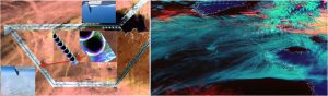
Almost simultaneously, in Oberpfaffenhofen, the electrical and mechanical approval of the installed trace gas instrumentation in the DLR Cessna aircraft was successfully completed. Furthermore, the electromagnetic compatibility (EMC) test was performed. This test is necessary to test the radio frequencies used by the pilot in the aircraft for communication with the Air Traffic Control (ATC). All the tested frequencies were free of interference when the installed trace gas instrumentation was switched on. The first draft of a test flight to Ingolstadt on Thursday 28th May was developed. This flight contains elements of (1) satellite validation (forecasted TROPOMI pixels in pink to be crossed in the centre), (2) eddy covariance and (3) mass balance approach for anthropogenic fluxes from agriculture and point sources (red dots: biogas plant and Ingolstadt city plume). The main flight pattern (yellow box) will be flown on different altitudes up- and downwind of the two-point sources.
Friday 22 May
One of the last steps in the integration of the airborne instrumentation is the wiring of all instruments. Today the wiring of the meteorological pod in the DLR Cessna aircraft, called “Black Mamba”, took place. With this pod a number of meteorological parameters can be measured, as e.g. different kind of temperatures and pressures, the water vapour content, and the 3D wind, meaning that in addition to the two horizontal wind components also the vertical wind component can be obtained. For certain applications, as flux estimates (e.g. eddy covariance), a high temporal resolution of such measurements is of high importance. Measurements with a high resolution of <0.1 s can be provided from this system designed especially for the DLR Cessna.
Thursday 21 May
In addition to the DLR instrumentation already installed on the DLR Cessna aircraft on 19th May), a further rack, containing the flask sampling unit C-JAS (Jena Air Sampler) provided by MPI-Jena was installed electrically today. The ambient air, sampled in flasks with this device, will be analysed in the laboratory (gas chromatography) after the field campaign. With this method a large variety of trace gases can be determined. For the objective of our field experiment, the major gases will be CH4 and its isotopologues, CO2 and N2O. In a further step, these flask measurements can be compared to the in situ measurements gained from the Picarro and MIRO instruments.
Wednesday 20 May
In Palaiseau, where AirCore launches will be organized from the SIRTA observatory supersite, a special training session was organized by the LMD team. The goal: to present the instruments and technical objectives for AirCore launches, and train the dozens of people that will actively participate to the preparation, launches, recovery and analyses of the atmospheric air sampler.
One of the trickiest parts of the instrument integration in the DLR Cessna is the laying of the three inlet tubes for the PICARRO, MIRO and JAS racks. All of the instruments need Teflon tubes with different cross-section dimensions depending on the required air flow to the instruments. These tubes are installed below the airplane wing and then directed into the aircraft through the wing.
Monday 18 May to Tuesday 19 May
Over the last two days, DLR Cessna-Caravan aircraft has been prepared intensively for the MAGIC-AVALON field campaign. On 19th of May, the three trace gas racks (PICARRO and MIRO from DLR, and the JAS flask sampling unit from MPI-Jena) were installed on DLR Cessna-Caravan. The PICARRO and MIRO instruments are measuring a number of trace gases in-situ, this means that an inlet is mounted on the aircraft which sucks the ambient air into the aircraft. Both instruments are spectrometers, based on cavity ringdown and direct absorption techniques, respectively. The main greenhouse gases measured with this installation are CH4, CO2 and N2O.
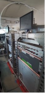
Monday 11 May to Tuesday 19 May
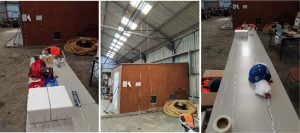
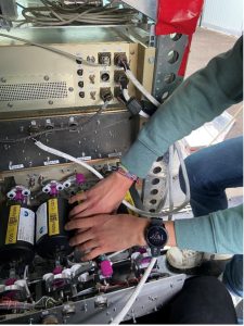
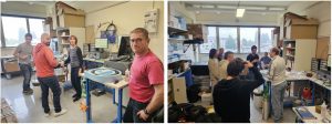
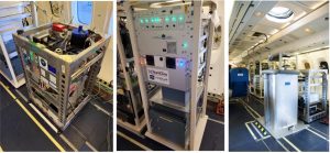
During these two weeks, no less than 5 teams worked hard to prepare SAFIRE ATR42 at Frankazal airport, installing in-situ and remote sensing instruments onboard SAFIRE ATR42.
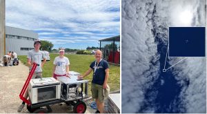
The LPC2E team installed SPIRIT (SPectromètre InfraRouge In situ Troposphérique) and performed functional tests with nominal results: real-time meaurements of the trace gases CO, CH4, NO2, N2O each 1.6 s by infrared ultra-high-resolution spectroscopy coupling a multipass cell to 3 Quantum Cascade Lasers.
The LAERO team installed the IAGOS bay (130 kg) on 13th May. It includes three instruments: IAGOS Package1 (O3, CO), IAGOS miniO3 (prototype O3 with internal calibration) and AEROLAB O4C (prototype for CO2/CH4). All tests, included communication with Safire systems (Time synchronisation, MQTT, Graphicator) were completed on 19th May.
The same day, the same bottle of gas target for CO2/CH4/CO was successfully recorded by Safire/LSCE Picarro (CO2/CH4), IAGOS Package1 (CO) and AEROLAB O4C (CO2/CH4).
Finally, the CNES team successfully installed the CO2 comb lidar SCALE at the rear of the aircraft.
To close these two weeks, great news were received: ATC has granted flight authorization to SAFIRE for the MAGIC-AVALON target zones!
Thursday 7 to Saturday 9 May
On 7 and 8 May, integration of Telops Hyper-Cam and SWING onboard SFS Tecnam P2012 was performed in “Les Éplatures” airport, La Chaux-de-Fonds, Switzerland. Test flight was organized on 9 May. Hyper-Cam geocorrection looks ok and Telops is optimizing it. Black band/track due to an out of tolerance attitude of the aircraft is under investigation. SWING was not operated in the test flight due to a wiring issue with the Applanix IMU that was solved after the flight.
Thursday 9 April
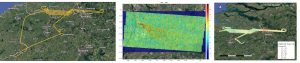
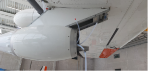
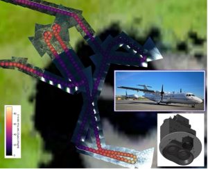
On April 9th, a first test/science flight was conducted following the integration of OSIRIS and the baffled CMP22 aboard the ATR-42. The very successful flight occured during a Metop-SG-A1 overpass and allowed acquisition of 3 hours of data over land and ocean under clear sky or cloudy conditions. Several transitions from land to clear sky ocean leading to sharp modification in upwelling SW flux, especially provide valuable data to test the observation concept of the ECO mission (Earth Explorer 12 candidate). While 3MI/Metop-SG-A1 data are not publicly available yet, this flight also provide valuable data for the 3MI Cal/Val activities, one of the key objectives of the MAGIC-AVALON campaign in June.
Thursday 2 April
Today, the Kick-Off meeting for the preparation of MAGIC-AVALON took pace online. It gathered 51 partners from the twenty European teams participating to the campaign. Representatives from our funding agencies, CNES, ESA and EUMETSAT, presented their views and expectations on the campaign. It was followed by an overview of all the instruments that will be deployed during the campaign on aircrafts -, under light balloons and on the ground, as well as the various numerical models that will be used to prepare, implement and then analyze the measurements. A great occasion for each team to get a chance to discover in more details what the other teams will bring to the campaign and start fostering collaborations!
Link to campaign operational website
https://observations.ipsl.fr/aeris/avalon/#/map
Press
Aerobuzz: L’ATR 42 Safire en campagne scientifique à Calais
Acknowledgements
The MAGIC-AVALON campaign is funded by CNRS, CNES through its annual research program (PARS, project IASI-NG), by ESA throught the MAGIC-POEM project and by EUMETSAT. Belgium partners are also supported by the BEAM project funded by Belspo.